

This post may contain affiliate links, meaning if you buy or book through one of these links, I may earn a small commission .
Looking for an approachable yet scenic hike to do on your next trip to the U.S. Virgin Islands? The Lind Point Trail on St. John is the perfect choice. This fairly flat trail offers two possible routes that lead to a pair of gorgeous Caribbean beaches from downtown Cruz Bay.
Sound awesome to you? My husband and I think so too, as we’ve hiked the Lind Point Trail many times to reach glistening Honeymoon Beach on St. John’s north shore. You don’t even need to pack your whole life with you, as snacks and chairs rentals are available steps away from the water.
This one-mile (one way) trail is long enough to feel rewarding, but not so much that it’s intimidating. Plus, the views over Cruz Bay along the way and the beaches at the end make the Lind Point Trail an overall pleasant experience. To help your hike stay as stress-free as it should, below I am providing all the information you need before you embark.
What You Need to Know About the Lind Point Trail in St John
Lind Point Trail – Quick Facts
- Length: 2.3 miles out and back (depending on whether you are taking the upper or lower Lind Point Trail)
- Difficulty: Easy
- Time: 40 minutes to 1 hour
- Terrain: Mostly flat dirt with some rocks. The Upper Lind Point Trail has some small inclines.
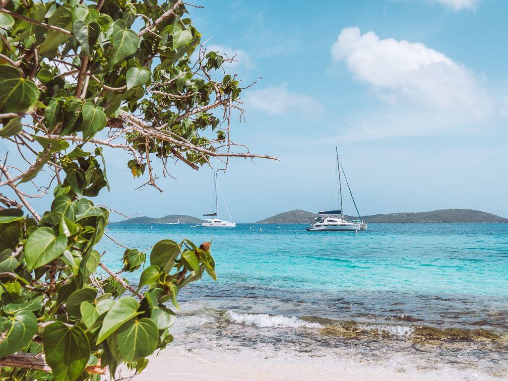
- Scenery: Beautiful views of Cruz Bay from the Lower Lind Point Trail, although the Upper Lind Point Trail has the more sweeping overlook. While the trail follows along the northwestern coast of St. John, the view is mostly obstructed by a layer of flora. Both trails lead to stunning Salomon and Honeymoon beaches.


What to Bring
Packing for the Lind Point Trail gets a little tricky, since you’ll likely want swim at Honeymoon or Salomon beaches before hiking back. The below list covers the necessities:
- Athletic Apparel. I recommend breathable shorts and a T-shirt for the typically hot, stuffy weather.
- Hiking shoes or sneakers. You may also be able to get away with sturdy sandals on the Lower Lind Point Trail.
- Swimsuit for a refreshing dip in the water.
- Towel to sit on and dry off at the beach.
- Hat to shade your face from the strong Caribbean sun.
- Reef-safe Sunscreen for the hike and beach. Australian Gold has long been our go-to.
- Bug spray since you don’t want to be scratching your ankles all trip.
- Water bottle. We love our vacuum insulated water bottles (the water stays ice cold for hours).
- Camera to capture St. John’s stunning scenery.
- Cell phone for photos, directions, or in case of emergency.
For simplicity, we wore shorts and T-shirts over our swimsuits and brought our small items in one backpack. I wore my camera around my neck for easy access when we encountered a gorgeous view.
We did also carry two beach chairs and a small cooler with us, which made the hike a little harder. However, it was worth it to sit on the beach with a homemade painkiller in hand.
Related: The Ultimate Caribbean Vacation Packing List (Carry-on Only)
How to Access the Lind Point Trail
You will find the trailhead behind the Cruz Bay Visitor Center in downtown Cruz Bay. While there is a big parking lot around the building, all but a few highly competitive spots are reserved for employees. The good news is that hikers can simply request a parking pass from inside the visitor center.
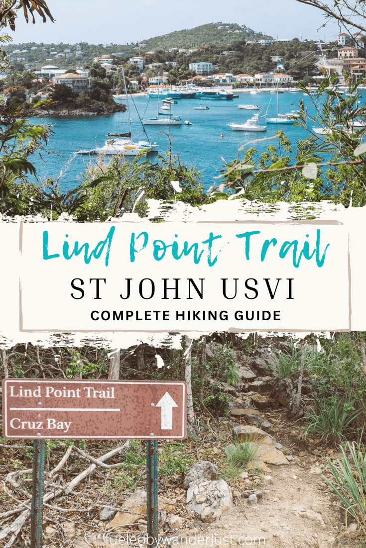
The trailhead is behind the building as you walk around it to the right (you’ll only find water to the left). The sign right by the flight of wooden stairs leading up to the trail is pretty easy to spot. Climb the stairs before keeping left to stay on the path.
What is the Lind Point Trail Like?
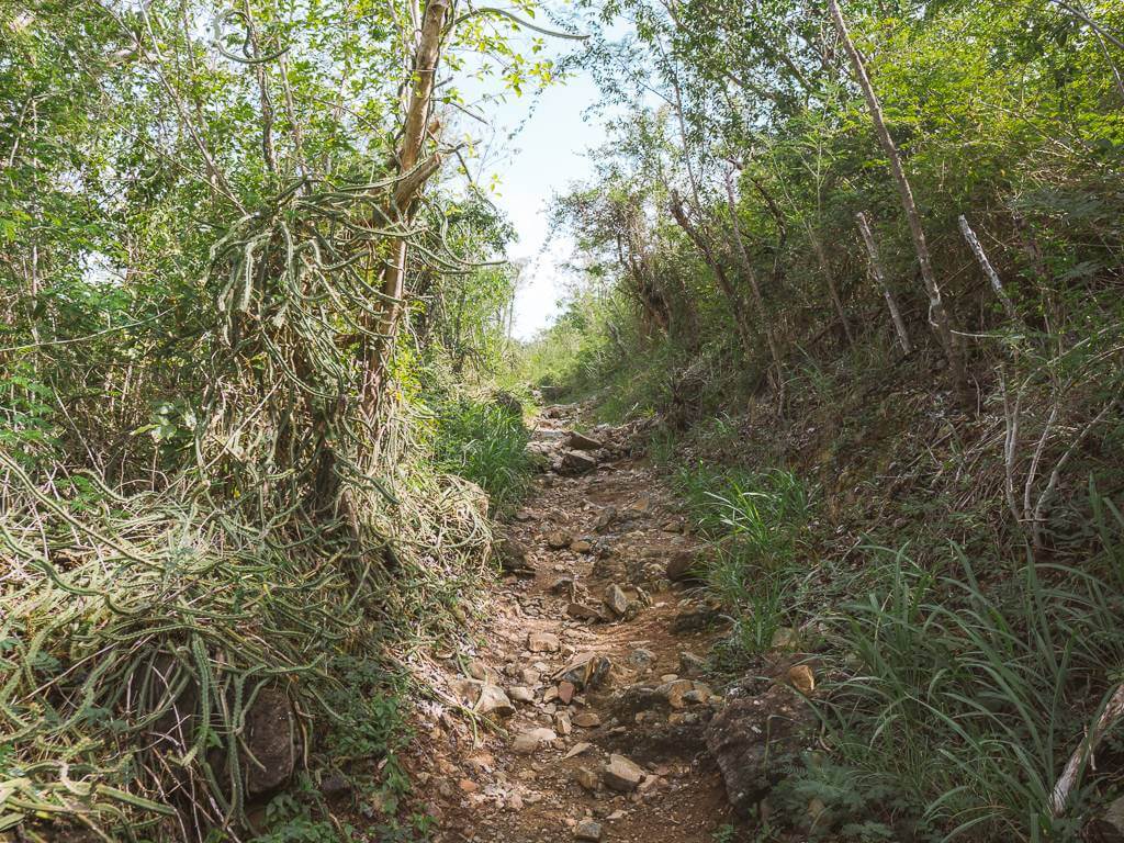
The Lind Point Trail is about a mile long (one way) and stays pretty flat, although small rocks add bumps along the way. The only time you will encounter inclines is leading down to the beaches or if you want to ascend to the Upper Lind Point Trail.
The trail basically circles you around the northwestern corner of St. John from Cruz Bay to the first two North Shore beaches. Going out, you can observe the brightly-hued buildings popping against the calm turquoise harbor of Cruz Bay.
As you circle along the westernmost part of the trail, you can steal glimpses of yet more water and the lush hills of St. Thomas through the trees. Though much of the view becomes obstructed, the remainder of the Lind Point Trail is pleasant and shady. Don’t be surprised if you meet the acquaintance of several hermit crabs crawling across your path!
While not crowded, this trail is fairly popular and you are sure to pass other hikers along the way. The earlier you head out, the higher the probability of solitude.
Related: 7 Amazing St. John Hiking Trails You Need to Try
Upper Lind Point Trail
Towards the beginning of the hike, there is a point where you can stay on the Lower Lind Point Trail or branch off to the Upper Lind Point Trail. Both options lead to the beaches, though the upper boasts a scenic overlook that its lower counterpart cannot match. It’s just a matter of whether you feel like doing a small climb or not.
We have done both versions of the Lind Point Trail while carrying a bunch of beach stuff. Both are doable, although I do find the Lower Lind Point to be less of a hassle. That’s probably why we’ve only done the upper trail once so far.


The Beaches
Salomon Beach comes up first along the Lind Point Trail, with Honeymoon Beach only requiring another one hundred yards or so of walking. You could easily plan to stop at both beaches during the hike to experience two different vibes.
Honeymoon
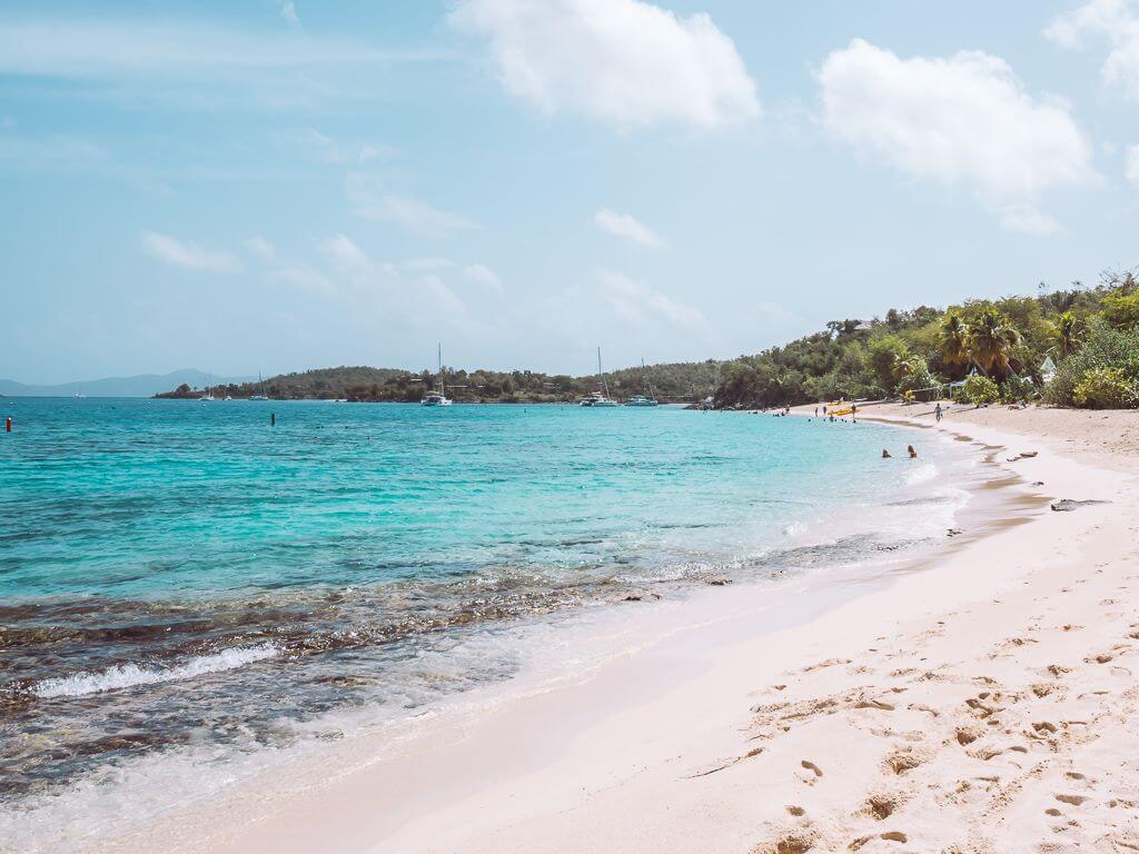
We like to start with the furthest out beach, Honeymoon, before popping into Salomon on the way back. We we’ve arrived before 10am, we’ve been pleased to find the beach pretty empty. However, Honeymoon doesn’t tend to reach the heavy traffic that the Trunk and Maho beaches do.
As the trail spits you out towards the westernmost part of the beach and away from the main entrance, it is easy to find a quiet spot. As you head down the beach towards the taxi entrance and amenities, it tends to get a little more crowded.
Unfortunately, shade is a premium here, especially since the cabanas and chairs of the Caneel Bay Beach Club have dominated the best spots.

The views at Honeymoon are drop dead gorgeous, with bright pops of aqua in the turquoise water and shadows of the BVI resting on the horizon. The swimming pool-like sea is great for snorkeling or floating around, but unfortunately kayak and stand-up paddle board rentals are no longer offered here.
Finally, Honeymoon Bay has the advantage of being full service, offering beach chairs, cabanas, casual dining, and shopping. Walk right up to the Caneel Bay Beach Club’s laid-back shack for simple food and drink offerings, including beer and cocktails. You’ll usually find us ordering a couple painkillers to enjoy.
Related: 8 Best St. John USVI Beaches: The Ultimate Guide
Salomon Bay
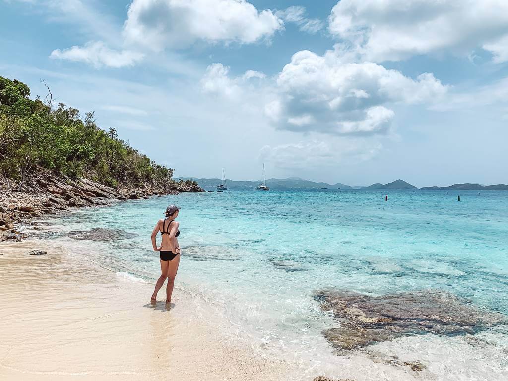
After a little time spent at Honeymoon, it’s time to take the short hike back towards Salomon. If you wish, make one more pit stop to enjoy a tiny, rugged contrast to Honeymoon’s long, luxurious expanse.
In fact, Salomon can bring the feeling of privacy and isolation even if you share the sand with a few others. Other than hiking the Lind Point Trail, this beach can only be reached by boat.
The water is a delight, being calm as could be and virtually translucent. Thankfully, this makes it easy to spot and avoid the large rocks slabs near shore. Despite its small size, the lack of people visiting Salomon usually means there are plenty of beach spots to choose from.
• • •
When you’re done at these dreamy beaches, simply head back the way you came (or switch between the upper/lower trail). It’ll be mildly exerting climbing back up the trail from the beaches, but this part ends quickly. From then on out it’s smooth sailing and the perfect opportunity to head into Cruz Bay for a snack while watching the boats come in.


Great description of what it would take to get there. The picture of the trail is the most helpful of any site I’ve been to, it helps me decide if I could walk it or not. Good job!
Thank you Marsha! I really appreciate this feedback 🙂
Loved your write up, very useful. Thank you
Thanks Chelsea! Happy to help 🙂
Hello,
Thank you so much for the information on Lind Point Trail. I am curious though as the maps for this trail show it looping back way before Honeymoon beach. Do the maps just not show the rest of the trail?
Thanks for any help.
That is correct. As you progress along the trail, you encounter some smaller side trails veering off to your left, going downhill. The first one you reach will lead to Solomon Bay, so you’ll need to keep hiking to reach Honeymoon. The trails should also be clearly marked with signage!